


Socorro County Precinct 24, Socorro County, New Mexico
About
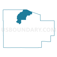
Outline

Summary
| Unique Area Identifier | 624192 |
| Name | Socorro County Precinct 24 |
| County | Socorro County |
| State | New Mexico |
| Area (square miles) | 437.23 |
| Land Area (square miles) | 436.76 |
| Water Area (square miles) | 0.47 |
| % of Land Area | 99.89 |
| % of Water Area | 0.11 |
| Latitude of the Internal Point | 34.41643830 |
| Longtitude of the Internal Point | -107.06760170 |
Maps


Graphs
Select a template below for downloading or customizing gragh for Socorro County Precinct 24, Socorro County, New Mexico


Neighbors
Neighoring Voting District (by Name) Neighboring Voting District on the Map
- Socorro County Precinct 13, Socorro County, NM
- Socorro County Precinct 15, Socorro County, NM
- Socorro County Precinct 16, Socorro County, NM
- Socorro County Precinct 21, Socorro County, NM
- Socorro County Precinct 25, Socorro County, NM
- Socorro County Precinct 26, Socorro County, NM
- Socorro County Precinct 9, Socorro County, NM
- Valencia County Precinct 20, Valencia County, NM
- Valencia County Precinct 27, Valencia County, NM
- Valencia County Precinct 33, Valencia County, NM
Top 10 Neighboring County Subdivision (by Population) Neighboring County Subdivision on the Map
- Belen CCD, Valencia County, NM (20,808)
- Socorro CCD, Socorro County, NM (14,354)
- Magdalena CCD, Socorro County, NM (3,415)
Top 10 Neighboring Place (by Population) Neighboring Place on the Map
Top 10 Neighboring Unified School District (by Population) Neighboring Unified School District on the Map
- Los Lunas Public Schools, NM (48,173)
- Belen Consolidated Schools, NM (30,853)
- Socorro Consolidated Schools, NM (12,352)
- Magdalena Municipal Schools, NM (2,984)
Top 10 Neighboring State Legislative District Lower Chamber (by Population) Neighboring State Legislative District Lower Chamber on the Map
Top 10 Neighboring State Legislative District Upper Chamber (by Population) Neighboring State Legislative District Upper Chamber on the Map
- State Senate District 29, NM (50,755)
- State Senate District 30, NM (48,188)
- State Senate District 28, NM (43,562)
Top 10 Neighboring 111th Congressional District (by Population) Neighboring 111th Congressional District on the Map
Top 10 Neighboring Census Tract (by Population) Neighboring Census Tract on the Map
- Census Tract 9781, Socorro County, NM (4,253)
- Census Tract 9709.02, Valencia County, NM (2,686)
- Census Tract 9713, Valencia County, NM (2,077)
- Census Tract 9782, Socorro County, NM (1,851)
- Census Tract 9711, Valencia County, NM (1,595)
Top 10 Neighboring 5-Digit ZIP Code Tabulation Area (by Population) Neighboring 5-Digit ZIP Code Tabulation Area on the Map
- 87031, NM (44,075)
- 87002, NM (22,517)
- 87825, NM (2,999)
- 87062, NM (1,869)
- 87823, NM (884)
- 87006, NM (703)
- 87831, NM (195)
- 87028, NM (145)